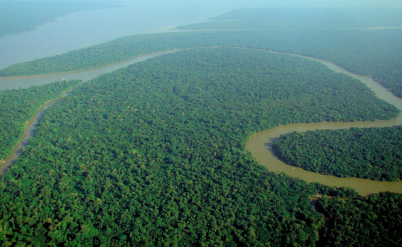
Every year, dust lifted from the Sahara Desert in Africa crosses the Atlantic Ocean and settles over the Amazon rainforest in South America. Yet this dust carries phosphorus (P) — a key nutrient that governs plant growth. Desert and atmosphere, ocean and rainforest, it turns out, are linked by an invisible chain. NASA’s satellite observations were the first to put a number on the scale of this remarkable connection.
NASA · Public domain · Wikimedia Commons · Source
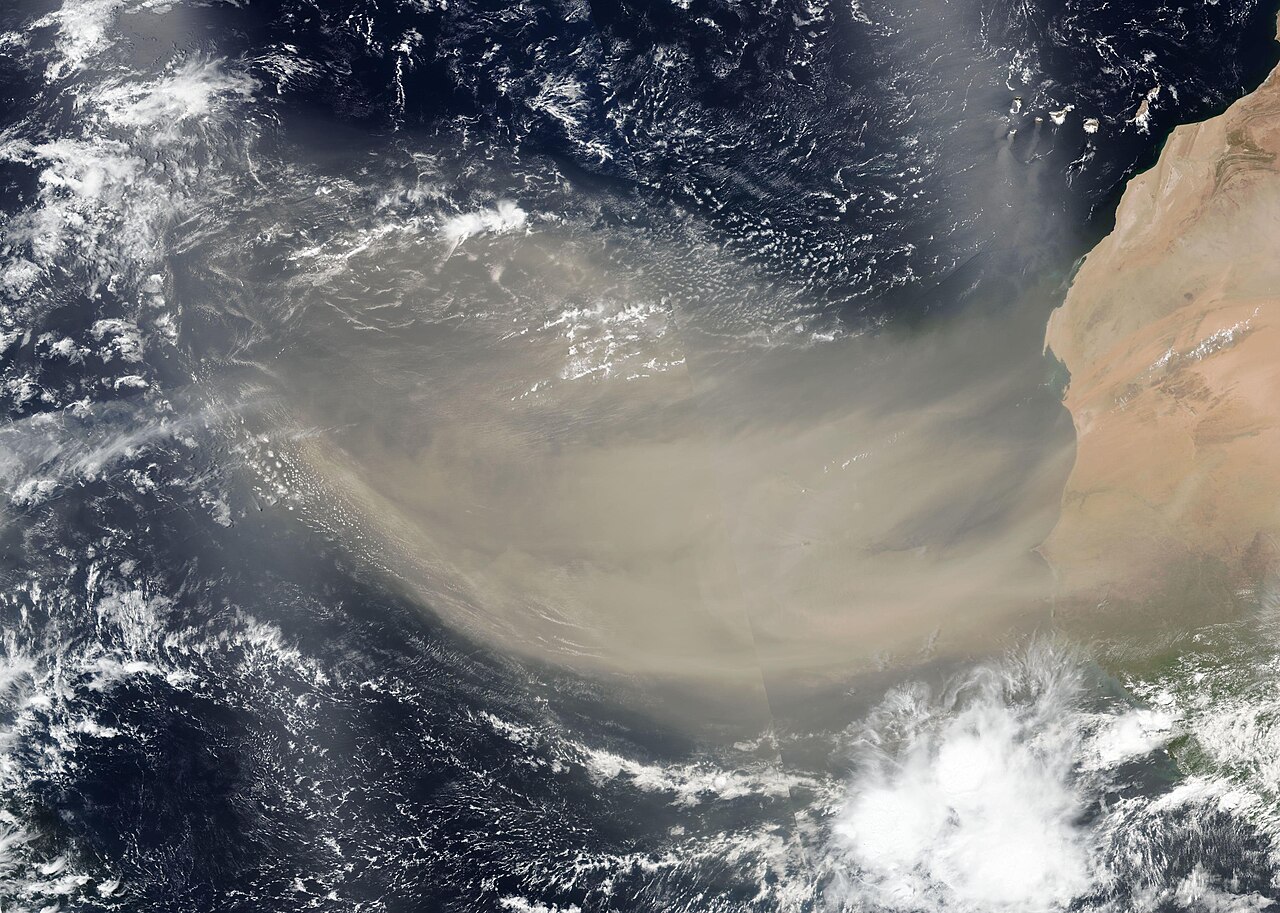
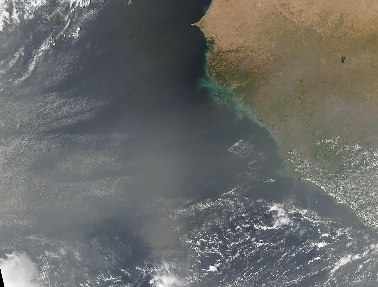
The road the dust travels across the Atlantic
According to NASA, wind and weather carry an average of about 182 million tons (182 Tg) of dust each year past the western edge of the Sahara (15°W). Of this, roughly 132 million tons stays aloft as far as the eastern coast of South America (35°W), and about 27.7 million tons (27.7 Tg) settles onto the surface of the Amazon Basin. The dust travels about 1,600 miles (roughly 2,600 km). Here, 1 Tg equals one million tons, so 27.7 Tg is 27.7 million tons.
These figures rest on a study published by Hongbin Yu and colleagues in 2015 in the journal Geophysical Research Letters, based on seven-year averages measured from 2007 to 2013 by the three-dimensional lidar (CALIOP) aboard the CALIPSO satellite. One point is worth underscoring: about 182 million tons is the amount “departing the West African coast,” while the amount that actually accumulates over the Amazon is about 27.7 million tons. It matters not to confuse the two numbers.
MODIS Land Rapid Response Team, NASA GSFC · Public domain · Wikimedia Commons · Source
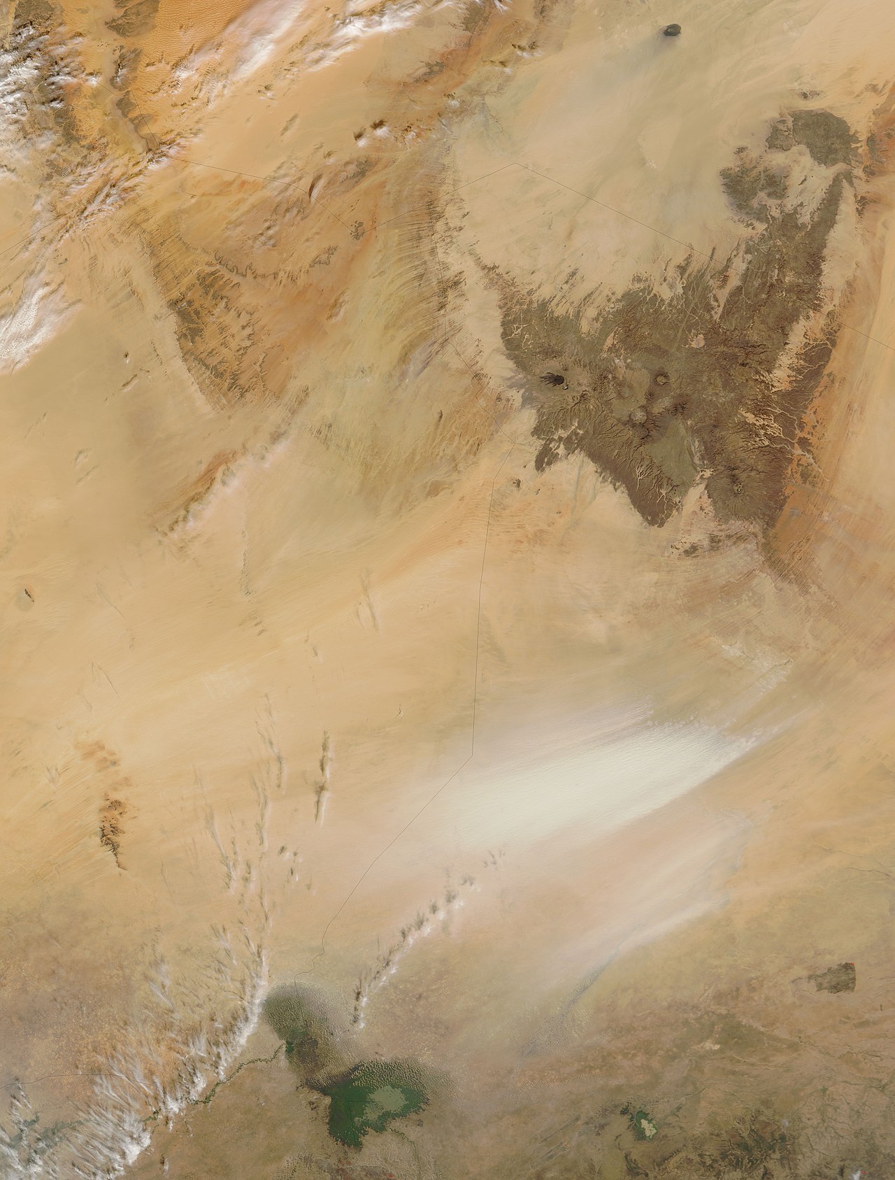
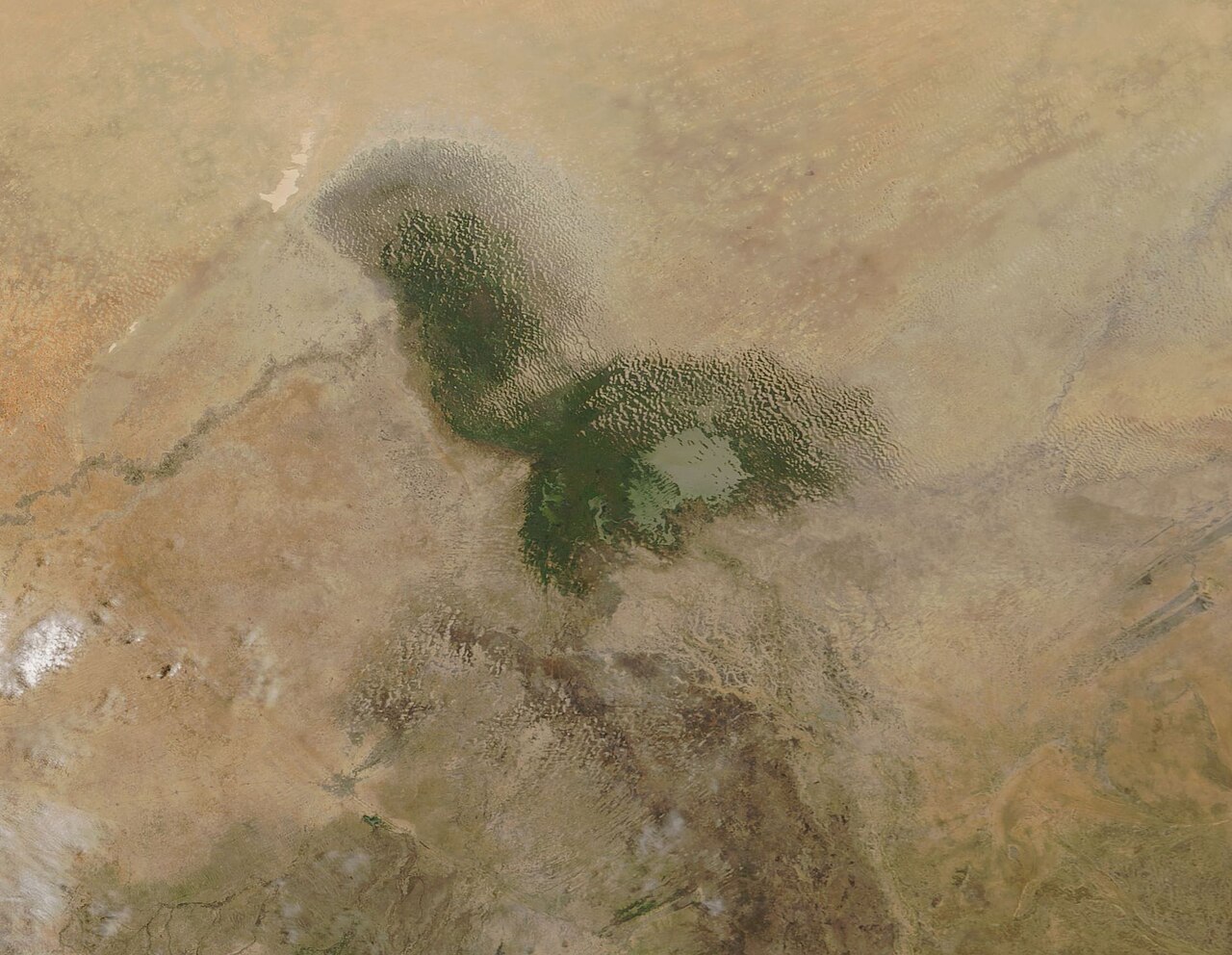
The dust’s homeland: the Bodélé Depression in Chad
Tracing where this dust comes from leads to the Bodélé Depression in northern Chad. Bodélé is counted among the dustiest places in the world, supplying about half of the mineral dust released from the Sahara.
NASA (MODIS Rapid Response, NASA GSFC) · Public domain · Wikimedia Commons · Source
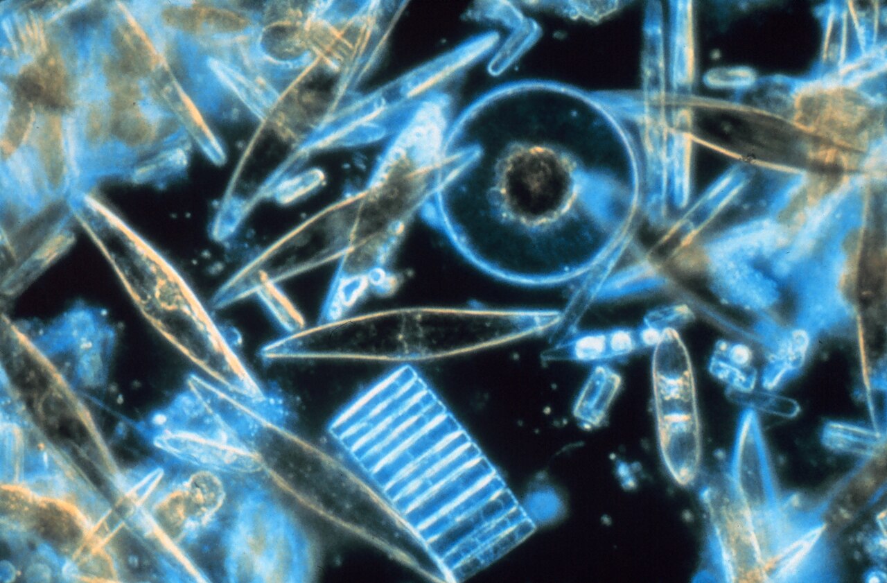
What is striking is that this place was once the floor of a giant lake. Until about 5,000 to 7,000 years ago, before the Sahara dried out, a vast lake of world-class size called Lake Mega-Chad spread across this region. As the lake dried, the exposed floor was left with diatomite — a deposit built up from the fossil shells of microscopic algae called diatoms. In this deposit, left behind by diatoms and other organisms of the old lake, phosphorus and other nutrients are concentrated together. In an extremely arid environment without a trace of vegetation, this layer crumbles and lifts into the air with ease. In NASA’s words, Bodélé is “an ancient lake bed of phosphorus-rich dead microorganisms.”
Prof. Gordon T. Taylor, Stony Brook University · Public domain · Wikimedia Commons · Source
The small Lake Chad that remains in the region today is the last trace of that giant Lake Mega-Chad after it shrank. The place where the lake’s northern part dried up is the Bodélé Depression of today.
Jeff Schmaltz, MODIS Rapid Response, NASA GSFC · Public domain · Wikimedia Commons · Source
The dry Harmattan wind blowing from the northeast is compressed and accelerated through the gorge between the Tibesti Mountains and the Ennedi massif in northern Chad, scouring this fossil deposit — a kind of natural “wind tunnel.” The lifted dust forms a thick, warm, dry “Saharan Air Layer” and crosses the Atlantic westward at an altitude of about 1,500 to 4,500 m.
The phosphorus that reaches the Amazon — seeing its meaning precisely
The roughly 27.7 million tons of dust that settle over the Amazon are estimated to carry about 22,000 tons of phosphorus per year (0.022 Tg P). This value, however, carries a wide uncertainty range of 6,000 to 37,000 tons, so one cannot assert “exactly 22,000 tons every year.” Moreover, the year-to-year variation is very large: between 2007, the highest year, and 2011, the lowest, there was as much as an 86% difference. This number, then, should be understood as “a satellite-estimated average that swings widely from year to year.”
So what does this phosphorus mean for the Amazon? Amazon soils are geologically old and highly weathered, leaving them very poor in phosphorus. The paper by Yu and colleagues cites that about 90% of Amazon soils are phosphorus-deficient. Frequent heavy rain constantly washes phosphorus out of the soil into rivers and runoff. It is precisely here that the amount of phosphorus supplied by Saharan dust being “comparable to the phosphorus the Amazon loses to rain and flooding” takes on meaning. In NASA’s phrasing, it is “about the same amount as that lost.”
lubasi · CC BY-SA 2.0 · Wikimedia Commons · Source
That said, overstatement is off-limits here. “Comparable in scale” does not mean “exactly offsets,” and still less does it mean “the Amazon depends on Saharan dust to survive.” The Amazon’s nutrient cycle runs mostly as a closed loop within the forest. As fallen leaves decompose, roots and mycorrhizae take their nutrients back up, so a large share of the phosphorus is recycled inside the forest. Saharan dust serves to replenish the “net loss” that this closed cycle slowly leaks to rainfall — a small but necessary top-up that, over timescales of decades to centuries, helps stave off the depletion of phosphorus.
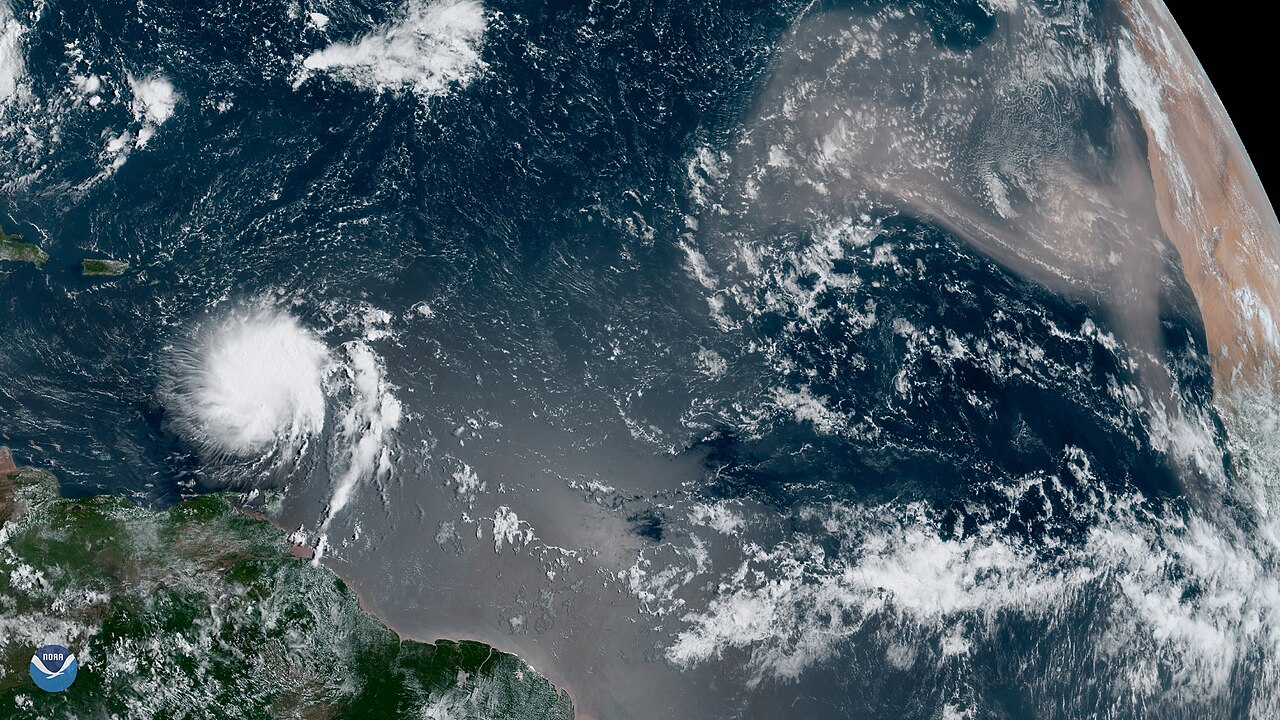
The two faces of the same dust: calming Atlantic hurricanes
Yet the very same Saharan dust does something entirely different while it is still passing over the middle of the Atlantic. This time it is not a “fertilizer” but a “suppressor of storms.” According to the U.S. National Oceanic and Atmospheric Administration (NOAA), the dust-laden Saharan Air Layer holds back Atlantic hurricanes in three ways. First, air about 50% drier than the typical tropical atmosphere triggers downdrafts around a storm and saps its strength. Second, the African Easterly Jet that blows with this layer ramps up “vertical wind shear” — winds that shift direction with height — hampering a hurricane from rising straight up and gathering power. Third, the warm air of the Saharan Air Layer rides atop the cooler air below to form a temperature inversion, stabilizing the atmosphere and suppressing cloud development.
NOAA Satellites · Public domain · Wikimedia Commons · Source
This effect stands out between mid-June and mid-August, when Saharan dust crosses most vigorously, damping the storm formation of the early Atlantic hurricane season. Of course, this is not an “absolute shield” but a statistical tendency. The flip side of the same logic is that major hurricanes cluster in the later part of the season — late summer into autumn — when the dust subsides.
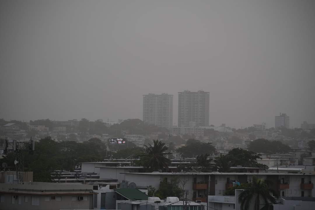
The same dust has a third face as well. Reaching the Caribbean and the southeastern United States after crossing the Atlantic, Saharan dust hazes over the sky and raises fine-particle concentrations, degrading air quality, and it scatters sunlight to produce unusually red sunsets. A handful of dust shows an entirely different face on each continent it touches.
Maryamarce · CC BY-SA 4.0 · Wikimedia Commons · Source
The handful of dust that links the Earth
The fossils of microorganisms left where an ancient lake dried up ride the wind across a continent and slowly replenish the soil of a rainforest on the other side of the planet. And over the sea along the way, the same dust tightens its grip on storms and shifts the color of the Caribbean sky. That desert and atmosphere, ocean and rainforest are interlocked into a single chain reminds us anew how intricately the world we live in is designed. Even a handful of dust, it seems, rests where it does for a reason, doing its part.
References
- Yu et al. 2015, The fertilizing role of African dust in the Amazon rainforest, Geophysical Research Letters (OSTI open-access PDF)
- Yu et al. 2015, Geophysical Research Letters 42:1984–1991 (doi:10.1002/2015GL063040, original)
- NASA Goddard: NASA Satellite Reveals How Much Saharan Dust Feeds Amazon’s Plants
- NASA Earth Observatory: Bodélé Dust (Lake Mega-Chad and diatomite)
- NASA Science: Saharan Dust Reaches Across Atlantic Ocean
- NOAA/AOML: The Saharan Air Layer (hurricane-suppression mechanisms)
- Bodélé Depression — Wikipedia
- Saharan air layer — Wikipedia
- Diatomaceous earth — Wikipedia
- ATTO: Highly productive ecosystems on nutrient-depleted soils (the Amazon’s closed nutrient cycle)