
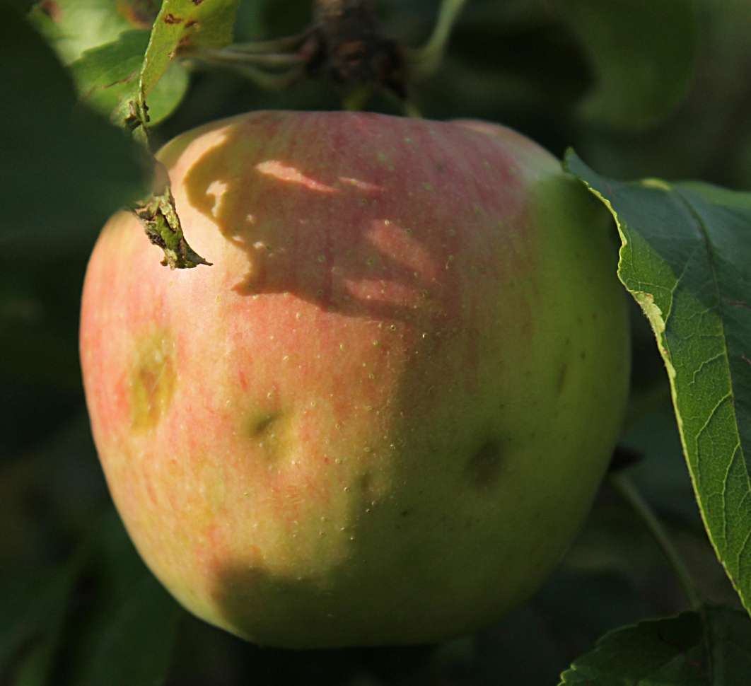
On the afternoon of June 11, 2026, hail 0.5-1 cm in diameter fell for one to three minutes over Dongnyang-myeon and Sancheok-myeon in Chungju, North Chungcheong Province, and over Baegun-myeon in Jecheon. Forty farms in Chungju (53 ha) and twenty farms in Jecheon (19 ha) reported damage, and more than 90% of them were apple orchards.
Credit: I.Sáček, senior · License: CC0 · Source: Wikimedia Commons
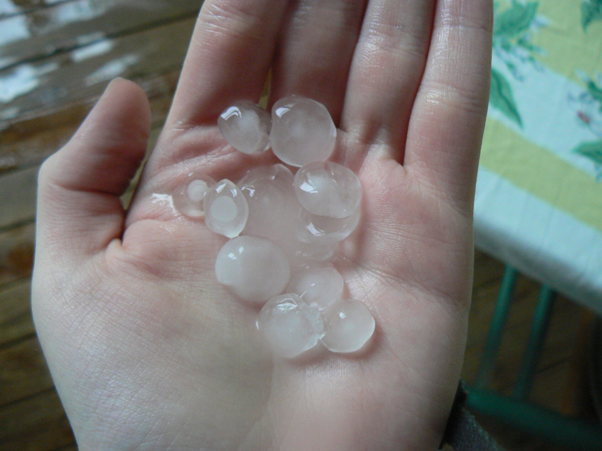
That same day, between 3 p.m. and 8 p.m., hail roughly 1 cm in diameter fell over inland and mountainous areas of Gangwon Province — Wonju, Hongcheon, Hoengseong, Jeongseon, and Cheorwon — damaging about 65.8 ha (roughly 199,000 pyeong) of farmland across 79 farms.
Credit: MaxFrear (talk) · License: CC BY 3.0 · Source: Wikimedia Commons
Three days later, on the afternoon of June 14, ice pellets also fell in Gyeonggi Province — Beopwon-eup in Paju (about 1 cm in diameter), Yeongtong-gu in Suwon (about 2 cm), and Hwaseong (1.5 cm, accompanied by thunder and lightning). Fortunately, no damage was reported to Paju city hall.
It was a time when early-summer heat had settled in. At first glance, the scene seems contradictory. Why would ice fall from the sky in a season when temperatures are climbing? The answer lies not in the weather we see at ground level, but in what is happening a few kilometers above it.
Ground-Level Heat, Below-Zero Aloft — The Troposphere’s Vertical Structure
The atmosphere’s temperature drops as altitude increases. In the troposphere, temperature falls by about 5-6°C for every 1 km gain in altitude (the lapse rate), and at the tropopause — the very top of the troposphere — temperatures at mid-latitudes drop to around -55°C. In other words, no matter how hot it is at ground level, the world just a few kilometers above is already one where ice forms.
Credit: Marek Wikipedista · License: CC BY-SA 4.0 · Source: Wikimedia Commons
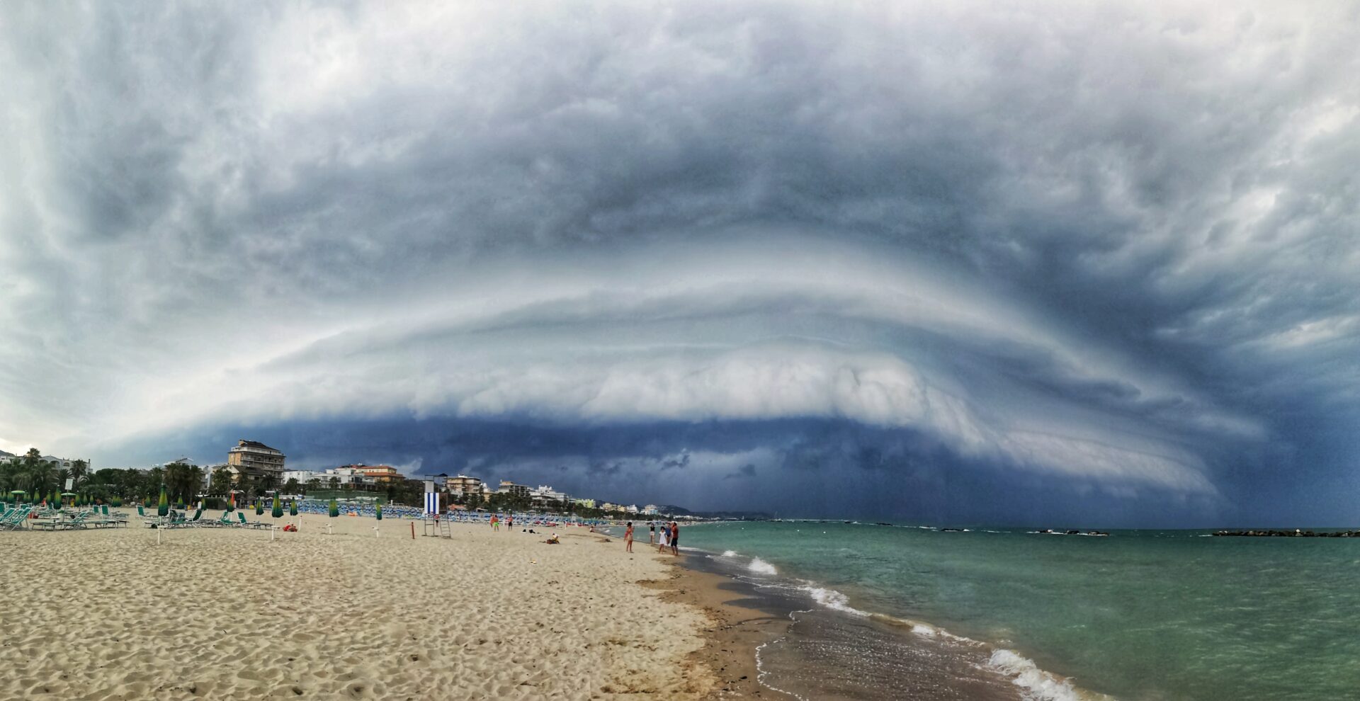
Local media covering the Chungju-Jecheon hail explained its cause as a process in which “heated surface air rises strongly and meets cold air at -10 to -30°C some 5-10 km above.” Air warmed at the surface surges upward and collides with a layer of cold air that was already sitting there. This vertical temperature structure exists everywhere in the troposphere at all times, regardless of season — it does not disappear in summer; only the boundary shifts up and down with the seasons.
So Is Hail Most Frequent at the Peak of Midsummer Heat?
In fact, it’s closer to the opposite. In Korea, hail mainly occurs in May-June, the transition from spring to summer, and in September-October, as fall begins. In winter, both upper- and lower-level temperatures are low and dry, making hail hard to form, while in midsummer temperatures are so high that hail often melts before reaching the ground, which reduces the number of observed cases. Ground-level temperatures on days when hail falls are generally known to be around 5-25°C.
There is another reason as well. For hail to form, convection must actively extend up to the altitude where water droplets and ice crystals coexist, but in midsummer, temperatures are often still above freezing even at the 500 hPa level (about 5,500 m), so the cold layer needed to freeze hail doesn’t sufficiently form in the first place. Conversely, this condition is more easily met in spring and fall, when the temperature difference between upper and lower levels widens sharply. At Daegwallyeong in Gangwon Province, a total of 46 hail events were recorded from the start of observations in 1971 through 2014, and about 26% of them (12 events) were concentrated in May. The situation is similar in the United States, where hail is said to be most common in spring through early summer, when the temperature contrast is greatest between the warm, moist air rising from the Gulf of Mexico and the cold air aloft. In the end, the hailstorms that swept across Korea one after another in June 2026 did not occur at “the height of midsummer heat,” but rather at a delicate moment when cold air aloft and early-summer heat at the surface precariously coexisted.
How Hail Grows — Updrafts and Supercooled Water
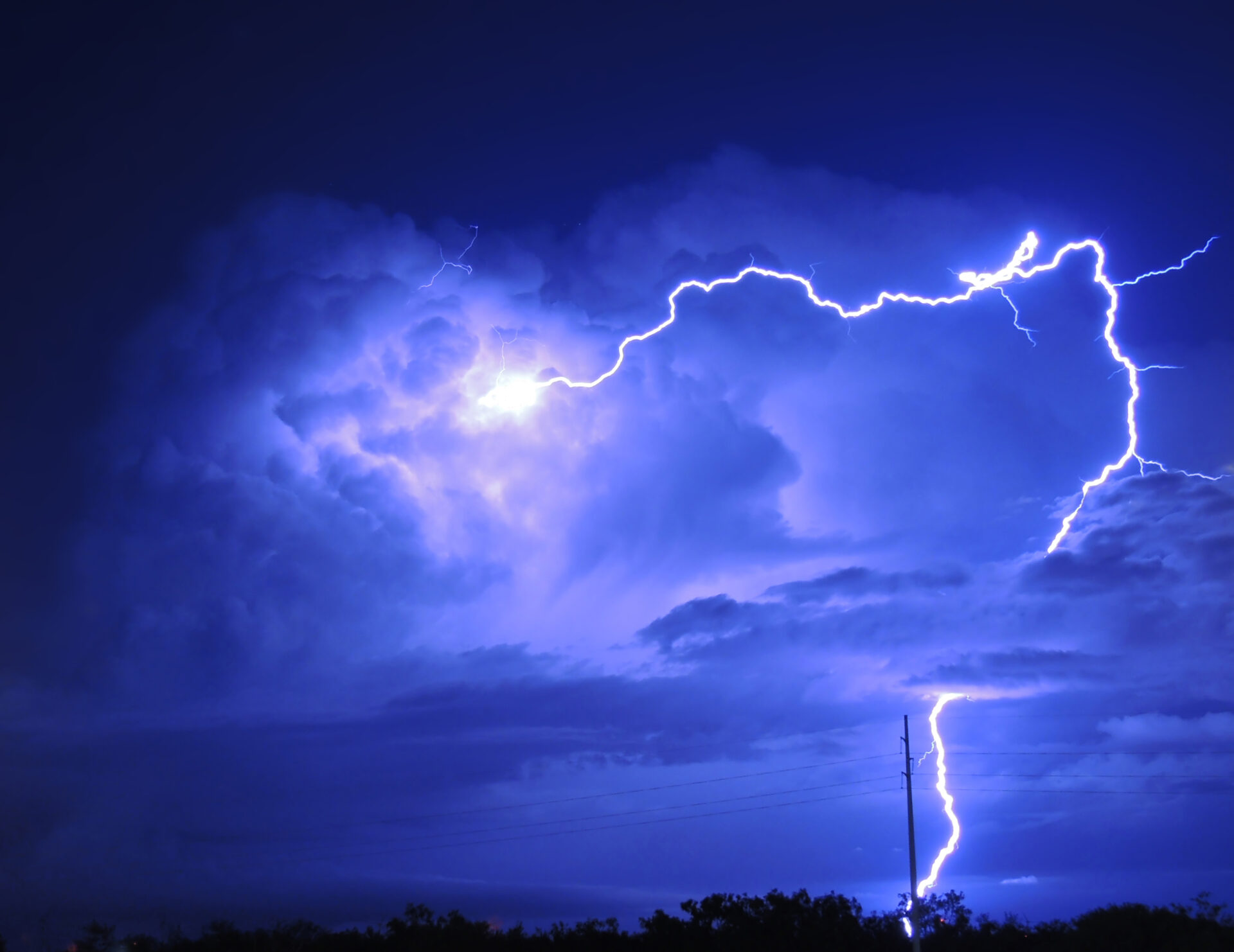
Hail forms inside cumulonimbus clouds (shower clouds) that have strong updrafts. When the atmosphere is unstable and a cloud develops vigorously in the vertical direction, ice pellets grow inside it.
Credit: NOAA Photo Library · License: Public domain · Source: Wikimedia Commons
The water droplets inside this cloud are in an unusual state: even when the temperature drops below 0°C, they don’t freeze and remain liquid — this is “supercooled water.” The instant one of these supercooled droplets collides with a tiny ice particle (a condensation nucleus), it freezes immediately, forming the seed of a hailstone, or hail embryo.
The reason a hail embryo formed this way doesn’t fall straight to the ground is that the updraft keeps holding it aloft. The updraft acts as buoyant support for the hailstone, and in strong thunderstorms its speed can exceed 100 km/h.
From a Hail Embryo to Onion-Like Layers
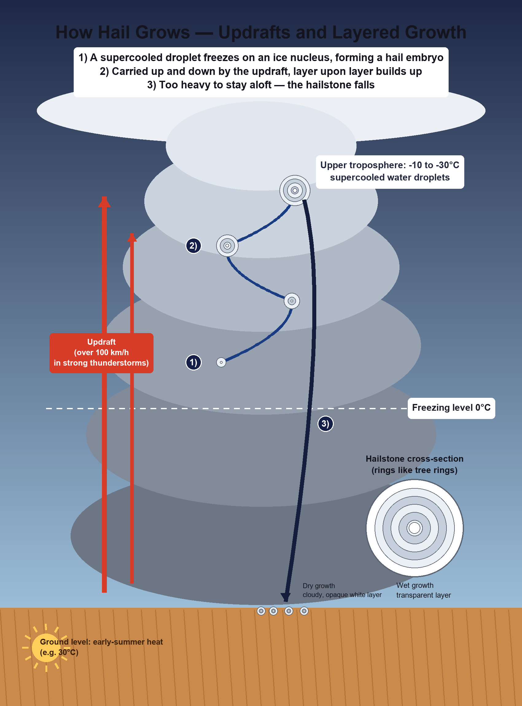
Illustration · self-made (matplotlib/PIL)
Once a hailstone has grown to a certain size, it briefly sinks under its own weight, then gets pushed back up again when it meets a strong updraft — a cycle that repeats. Each time it moves up and down like this, supercooled water droplets strike its surface or water vapor freezes onto it, adding a new layer of ice. As this process repeats many times, the hailstone’s cross-section ends up with a multi-layered structure, like an onion. The larger a hailstone is, the stronger and longer-lasting the updraft inside the cloud must have been.
Dry Growth and Wet Growth — Two Kinds of Ice Layers
There are also two ways in which these layers form. When the temperature is very low, water droplets freeze the instant they touch the surface; air bubbles get trapped inside the ice, producing a cloudy, opaque white layer (“dry growth”). Conversely, under relatively warmer conditions, water spreads thinly over the surface and freezes slowly, giving air bubbles time to escape, which produces a transparent layer (“wet growth”). The alternating white and transparent layers you see when a hailstone is cut in half are, in effect, tree rings that record exactly what temperature conditions the hailstone passed through as it rode the updraft up and down.
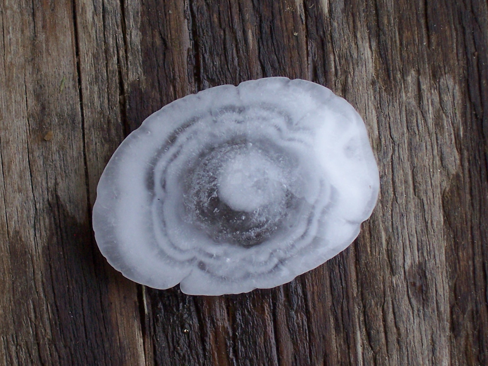
Credit: ERZ · License: CC BY-SA 3.0 · Source: Wikimedia Commons
Ideal Conditions for Hail Growth — and Its Limits
Several conditions must be met together for hail to form. The cumulonimbus cloud must have a high liquid water content, the cloud must develop strongly in the vertical direction, and the freezing level — the altitude at which water starts to freeze — must sit relatively low, at 3.4 km or below. Hail also forms more readily inland than in coastal areas.
Hail’s growth rate also has a distinct temperature range. Growth is fastest around -13°C, and it slows sharply once the temperature drops below -30°C, because unfrozen supercooled droplets themselves become scarce at such low temperatures. In other words, hail does not grow well at just any low temperature — it grows most actively within a fairly narrow “optimal zone” around -13°C.
Size Is Survival — The Bigger It Gets, the Faster and Harder It Falls
In meteorology, “hail” refers to ice pellets 0.5 cm or more in diameter. Anything smaller is classified separately as “graupel.” In Korea, hailstones around 1 cm in diameter are the most commonly observed.
Size translates directly into fall speed. A hailstone 1 cm in diameter falls at about 9 m/s (roughly 32 km/h), while one 8 cm in diameter falls at a much faster roughly 48 m/s (about 173 km/h). A hailstone the size of a baseball (about 7.3 cm) is said to fall at about 161 km/h. Beyond size, a hailstone’s fall speed also depends on how much its surface has melted, friction with the air, wind, and interactions with other raindrops or hailstones.
This is where a decisive difference between hail and rain emerges. As raindrops fall and grow larger, air friction breaks them apart, but hail, being solid, falls while keeping essentially the same size. Rather than the enlarged ice mass breaking apart on its own and losing force, it reaches the ground at essentially its original size. This is why large hail is far more dangerous to people and structures.
In practice, hail is generally known to start causing noticeable damage once it reaches about 2.0-2.5 cm or more in diameter. If an aircraft flies through a cumulonimbus cloud containing hail, hailstones larger than 13 mm (about 1.3 cm) can cause serious damage within seconds. The U.S. National Weather Service (NWS) classifies hail damage intensity into three tiers by size: coin to dime size (under about 1.0 inch) is “Moderate,” penny to ping-pong-ball size (about 1.0-1.5 inches) is “High,” and golf-ball size or larger (1.75 inches or more) is “Extreme.”
Hailstones on Record
World Records
According to the official record recognized by the World Meteorological Organization (WMO), the heaviest hailstone ever recorded fell in the Gopalganj region of Bangladesh on April 14, 1986, and weighed 1.02 kg. The hailstorm that produced it was reported to have killed 92 people.
The largest hailstone on record in the Western Hemisphere by diameter was observed in Vivian, South Dakota, USA, on July 23, 2010. The official figures first measured by the National Weather Service (NWS) office in Aberdeen were a diameter of 20.32 cm, a weight of about 0.88 kg, and a circumference of about 47.3 cm. However, a power outage at the time it was found delayed the measurement, so it was weighed and measured after considerable melting, and the survey turned up several other hailstones exceeding 6 inches (about 15 cm) in diameter. In other words, its actual size at the moment it hit the ground may well have been larger than the official record. The official record for the largest hailstone by circumference alone is 47.6 cm (about 18 cm in diameter), observed in Nebraska, USA, on June 22, 2003.
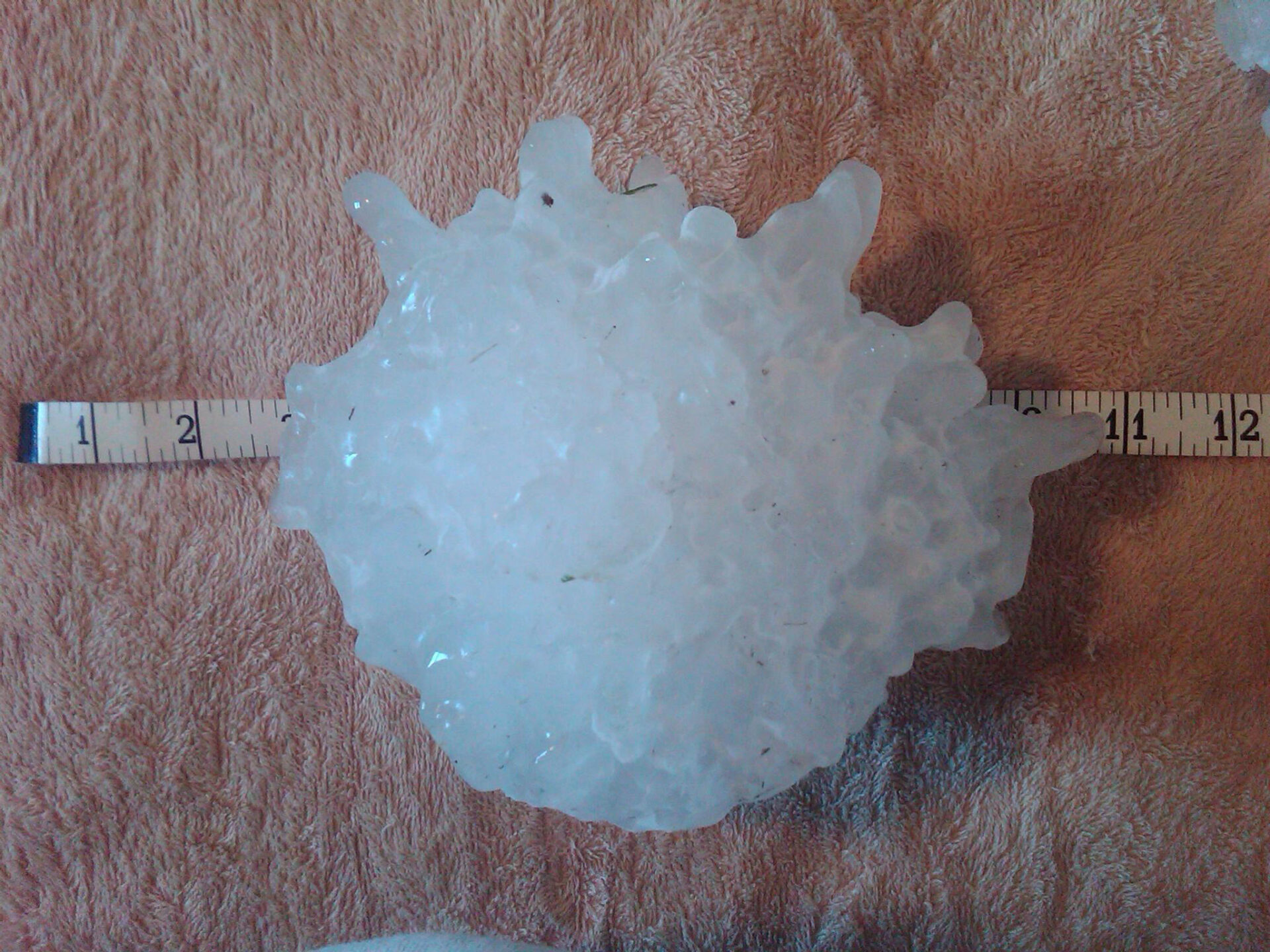
Credit: NWS Aberdeen, SD · License: Public domain · Source: Wikimedia Commons
Hail on the Korean Peninsula
Traces of hail can also be found in records from the Goryeo dynasty. The 「Goryeosa」 (History of Goryeo) records that in August of the 14th year of King Uijong’s reign (1160), hail “the size of a fist” fell, and that in August of the 16th year of King Myeongjong’s reign (1187), hail “the size of a fist” fell over Dongju (present-day Cheorwon, Gangwon Province) and Jangju (present-day Yeoncheon, Gyeonggi Province), shattering every roof tile. In May of the 27th year of King Chungnyeol’s reign (1301), it is said that huge hail fell over the Andong region of Gyeongsang Province, killing water deer, deer, and sparrows, with some hailstones reportedly too large for several people to lift together. People at the time regarded hail as jaei (災異) — an omen of disaster.
The hail that swept across North Chungcheong, Gangwon, and Gyeonggi provinces one after another in June 2026 formed through essentially the same mechanism as these old records. The only difference is that today, that mechanism can be explained in terms of updraft strength and the troposphere’s temperature structure.
The Atmosphere’s Precisely Interlocking Design
For a single hailstone to reach the ground, several stages of conditions must interlock with precision: the vertical temperature difference created by warm surface air and cold air aloft, the unstable liquid state of supercooled water, the force of the updraft that keeps the hailstone aloft, a growth rate that peaks around -13°C, and the sharp slowdown in growth below -30°C — only when all of these conditions are met at once does a hailstone of the size we see actually form. If even one condition is off, the hail either melts and falls as rain before it can fully grow, or never forms at all.
The fact that hail falls at a precisely different speed depending on its size, and that its growth history is etched layer by layer into its cross-section, is likewise no coincidence but the result of physical laws working with precision. The sight of ice falling from the sky on a sweltering summer day is not a contradiction — it is honest evidence that within the single space we call the troposphere, worlds of very different temperatures coexist at the same time. In spring and fall, during those brief transitional periods when warmth at the surface and cold air aloft stand in tense balance, the sky sends down its own precise design principle, in the form of ice.
References
- Chunks of Ice Pouring from the Sky, Hail — Kim Ji-young (Senior Researcher, KMA Weather Radar Center), The Science & Technology, June 2014
- World’s Heaviest Hailstone — Guinness World Records
- Record Setting Hail Event in Vivian, South Dakota on July 23, 2010 — National Weather Service (Aberdeen)
- Hail — Wikipedia (English)
- What Causes Hail? — WorldAtlas
- Tropopause — Korean Wikipedia
- Lapse Rate — Korean Wikipedia
- ‘Early-Summer Hail’ — Hail Damage in Chungju and Jecheon, North Chungcheong Province (June 11, 2026) — kdsn
- Unseasonably Early June Hail Pours Down… 200,000 Pyeong of Farmland Damaged in Gangwon — Kangwon Ilbo (June 15, 2026)
- Chunks of Ice Come Crashing Down… 1-2 cm Diameter Hail Falls in Paju and Suwon, Gyeonggi Province — The Kyunghyang Shinmun (June 14, 2026)