
Imagine checking a clock in the middle of the ocean. Its hands seem to tell you only the time. But a clock that has faithfully kept the time at a distant, known location offers something more: comparing that time with the local time aboard ship can reveal how far east or west you are.
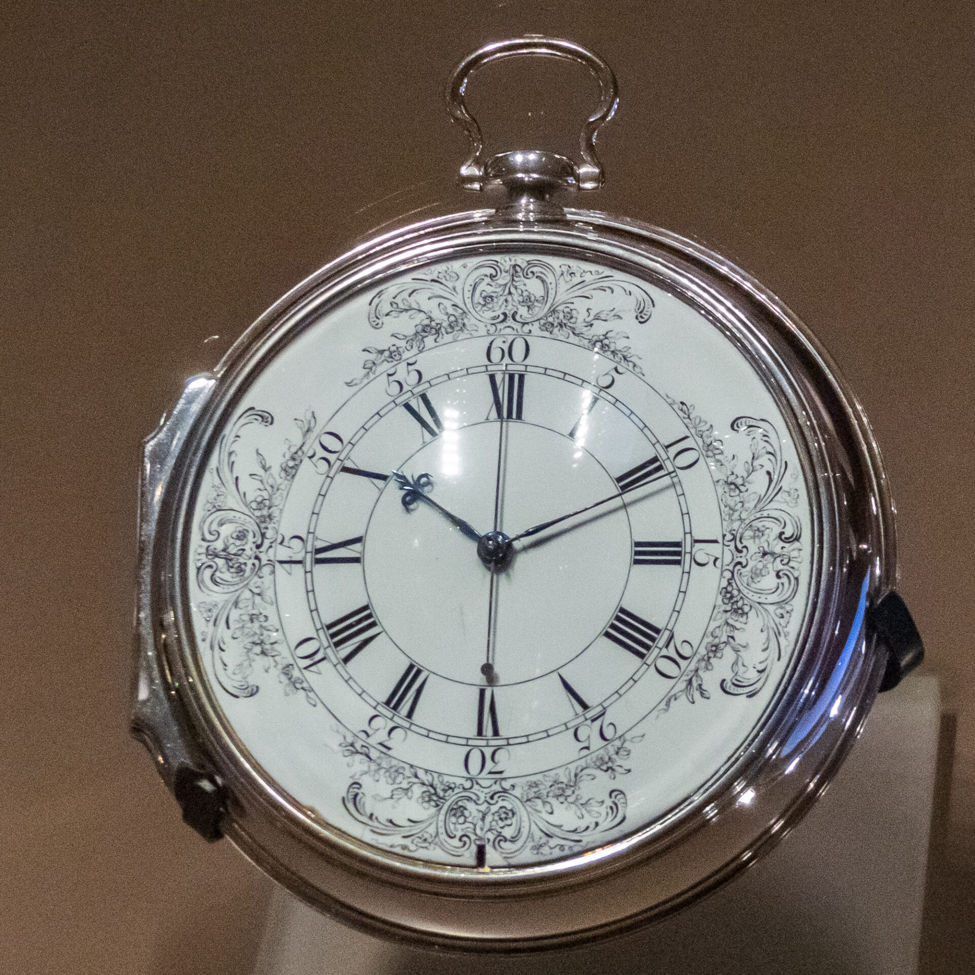
This was the problem that occupied the eighteenth-century clockmaker John Harrison. The clock did not read the ship’s position. It carried the time at another place, providing a quantity needed to calculate position. To understand his marine timekeeper H4, we should start not with its small gears, but with why noon arrives at different moments in different places on Earth.
Mike Prince from Bangalore, India · CC BY 2.0 · Wikimedia Commons
Why is east–west position connected to time?
Latitude is angular distance north or south of the equator; longitude is angular distance east or west of a reference meridian. Mariners could determine latitude by observing the altitude of the Sun or stars. Longitude required a different comparison. Because Earth rotates, the time of a celestial observation matters too.
A mean solar day contains 24 hours, corresponding to a full turn of 360 degrees relative to the Sun. That gives 15 degrees per hour. A time difference of one hour between two places therefore corresponds to 15 degrees of longitude; four minutes corresponds to one degree. The Sun crosses the meridian earlier at an eastern location than at a western one, so local time is ahead to the east. Comparing times offers a way to compare longitudes.
“Local time” here does not mean the civil time assigned to a time zone. Cities sharing a time zone can have different moments of solar noon because they lie at different longitudes. The relevant comparison is between time associated with the Sun’s motion at the ship’s location and time at a reference location of known longitude.
If it is 2 p.m. at the reference and noon aboard ship
Let us work through the direction. This example assumes that observational and clock corrections have already put both readings on the same mean-solar-time basis. Greenwich is our chosen reference meridian. These are illustrative values, not measurements from a particular Harrison voyage.
| Quantity | Assumed reading or calculation |
|---|---|
| Greenwich mean solar time preserved by the clock | 14:00 |
| Observed and corrected local mean solar time aboard ship | 12:00 |
| How far local time is behind the reference | 2 hours |
| Longitude difference | 2 hours × 15 degrees per hour = 30 degrees |
| Direction | West of Greenwich: longitude 30 degrees west |
Local time is behind the reference, so the ship is to the west. Conversely, if local time is two hours ahead of the reference at the same instant, the location is 30 degrees east of it. The clock hands do not carry an east or west label: the direction comes from which location’s time is ahead.
The Sun’s meridian passage marks noon in local apparent solar time. That cannot simply be equated with a mechanical clock’s uniformly running time. Apparent solar time and mean solar time differ through the year; this difference is called the equation of time. Our table assumes that this and clock errors have already been accounted for. Real navigation combined observation, astronomical tables and management of clock error.
Why not simply take a good clock to sea?
A clock that performed well on land was not guaranteed to do so aboard a ship. Motion could disturb its regulating mechanism, while changing temperatures affected its components and timekeeping. A marine timekeeper had to preserve the reference time reliably throughout a long voyage.
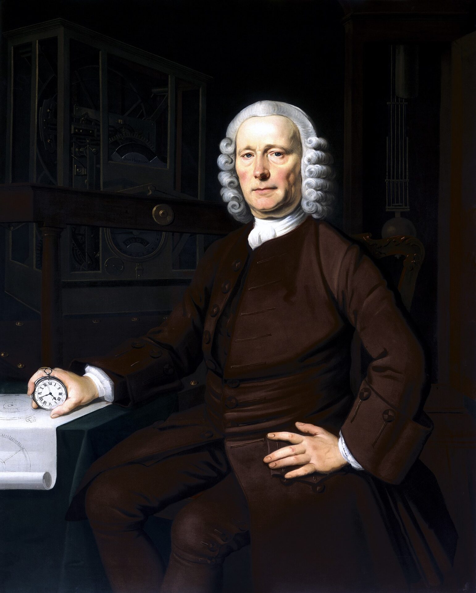
Harrison learned clockmaking while working as a carpenter. Britain’s Longitude Act of 1714 offered rewards graded by the accuracy of a method for finding longitude at sea. This was more than a contest with one prize and one winner: trials, development support and disclosure conditions were part of the process. Harrison approached the problem through precise mechanical timekeeping.
Thomas King · Public domain · Wikimedia Commons
A small error mattered. If four minutes of time correspond to one degree of longitude, a one-minute clock error corresponds to 0.25 degrees, other things being equal. The east–west distance represented by that angle varies with latitude, so it is not one fixed number of kilometres everywhere. The essential point is that timekeeping error carries into the position calculation.
H1 to H3: experiments with larger machines
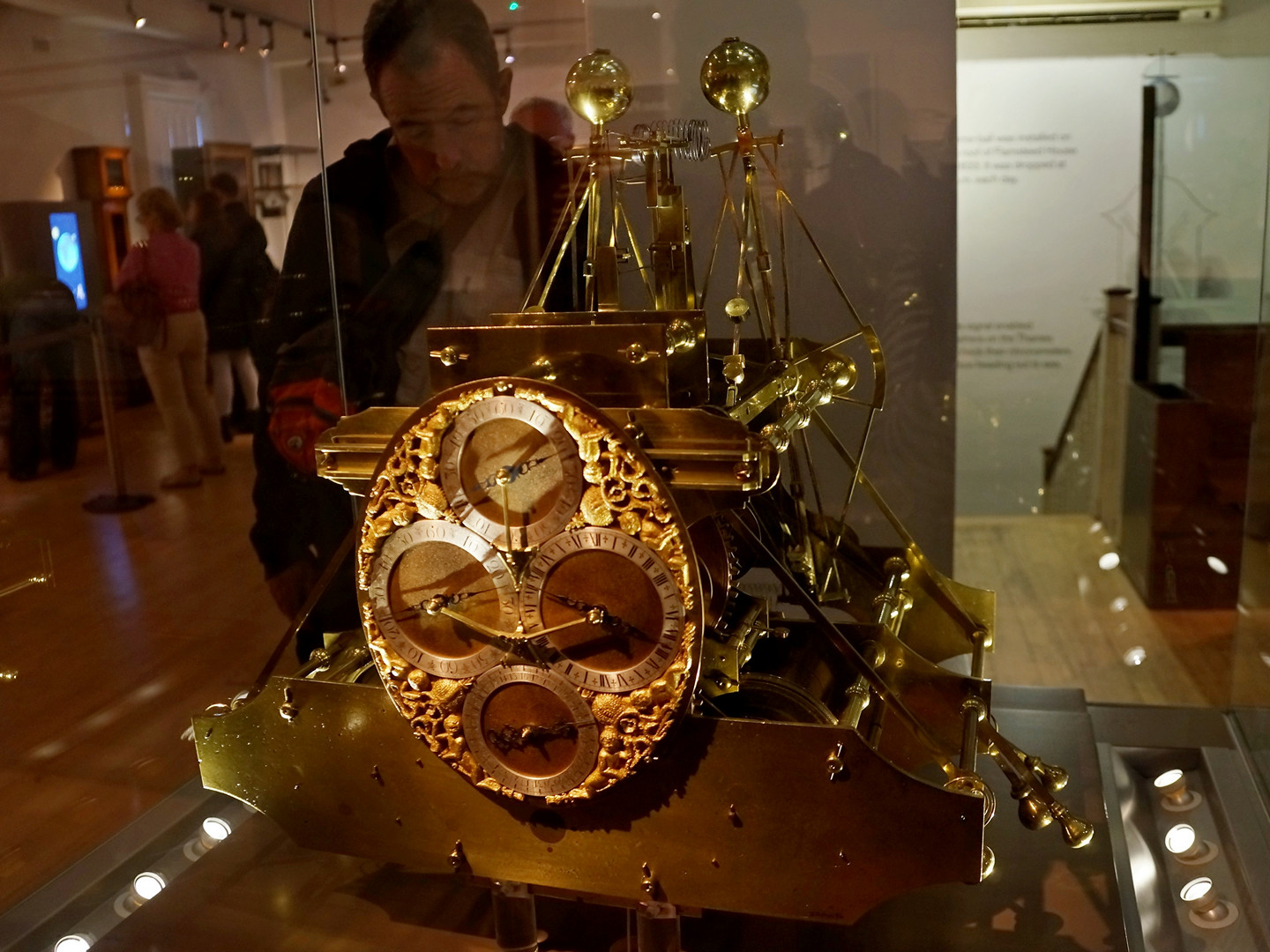
Harrison completed his first marine timekeeper, H1, in 1735. Its conspicuous paired, interconnected balances addressed timekeeping aboard a moving ship. This was not simply a domestic pendulum clock taken to sea. H1 underwent a real sea trial on a voyage to Lisbon in 1736.
Tatters ❀ from Brisbane, Australia · CC BY-SA 2.0 · Wikimedia Commons
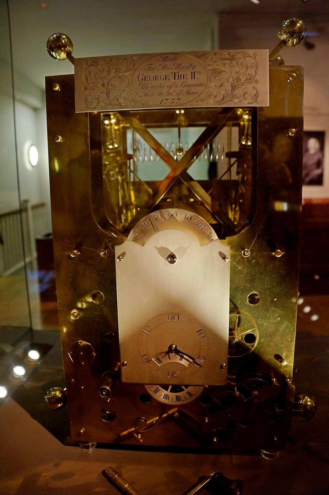
H2 followed, but did not undergo a sea trial. Its museum catalogue describes Harrison’s recognition of a problem with the design. A more refined-looking machine and dependable performance aboard ship were different achievements.
Tatters ❀ from Brisbane, Australia · CC BY-SA 2.0 · Wikimedia Commons
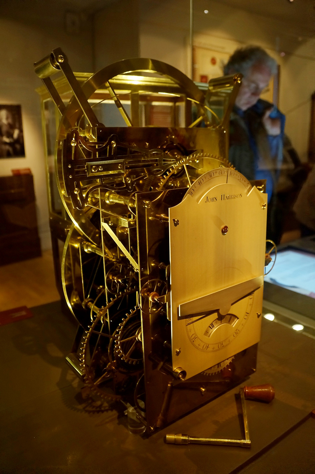
Work on H3 occupied almost 19 years. It incorporated new ideas, including a device to reduce the effects of temperature, but did not achieve the accuracy Harrison needed. H1, H2, H3 and H4 should therefore not be read as four smoothly improving finished products. Long investigations and unsuccessful approaches lay between them.
Tatters ❀ from Brisbane, Australia · CC BY-SA 2.0 · Wikimedia Commons
The successful direction led to the watch-shaped H4
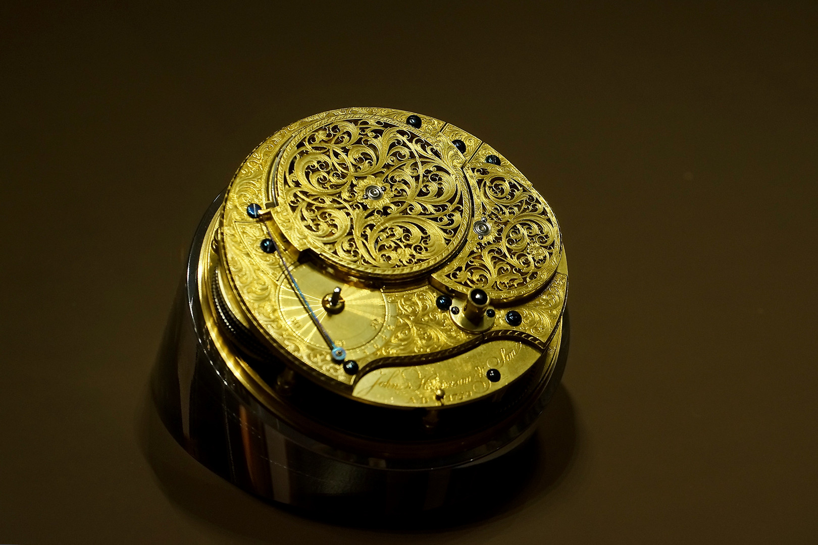
Completed in 1759, H4 looks strikingly different from its predecessors. Instead of a large brass framework, it resembles an oversized pocket watch. The Royal Museums Greenwich catalogue highlights its stable, high-frequency balance. Its success was not merely a matter of making the earlier machinery smaller; it explored a different approach to regulating time.
Tatters ❀ from Brisbane, Australia · CC BY-SA 2.0 · Wikimedia Commons
In 1761 Harrison’s son William set out with H4 on the trial voyage to Jamaica. Completion in 1759 and the trial beginning in 1761 are separate events. The Jamaica and Barbados sea trials showed high accuracy, though later test results remained contested. The rewards process did not immediately end either. Disclosure of the mechanism and whether other timekeepers could reproduce its performance were also at issue.
A parliamentary measure in 1773 provided for a further reward in addition to money already received. Saying that Harrison “first received a reward in 1773,” or received the entire top prize in one payment that year, erases the earlier development support and payments. Technical success, public verification and reward decisions were connected, but were not the same event.
Reading the Moon offered another route
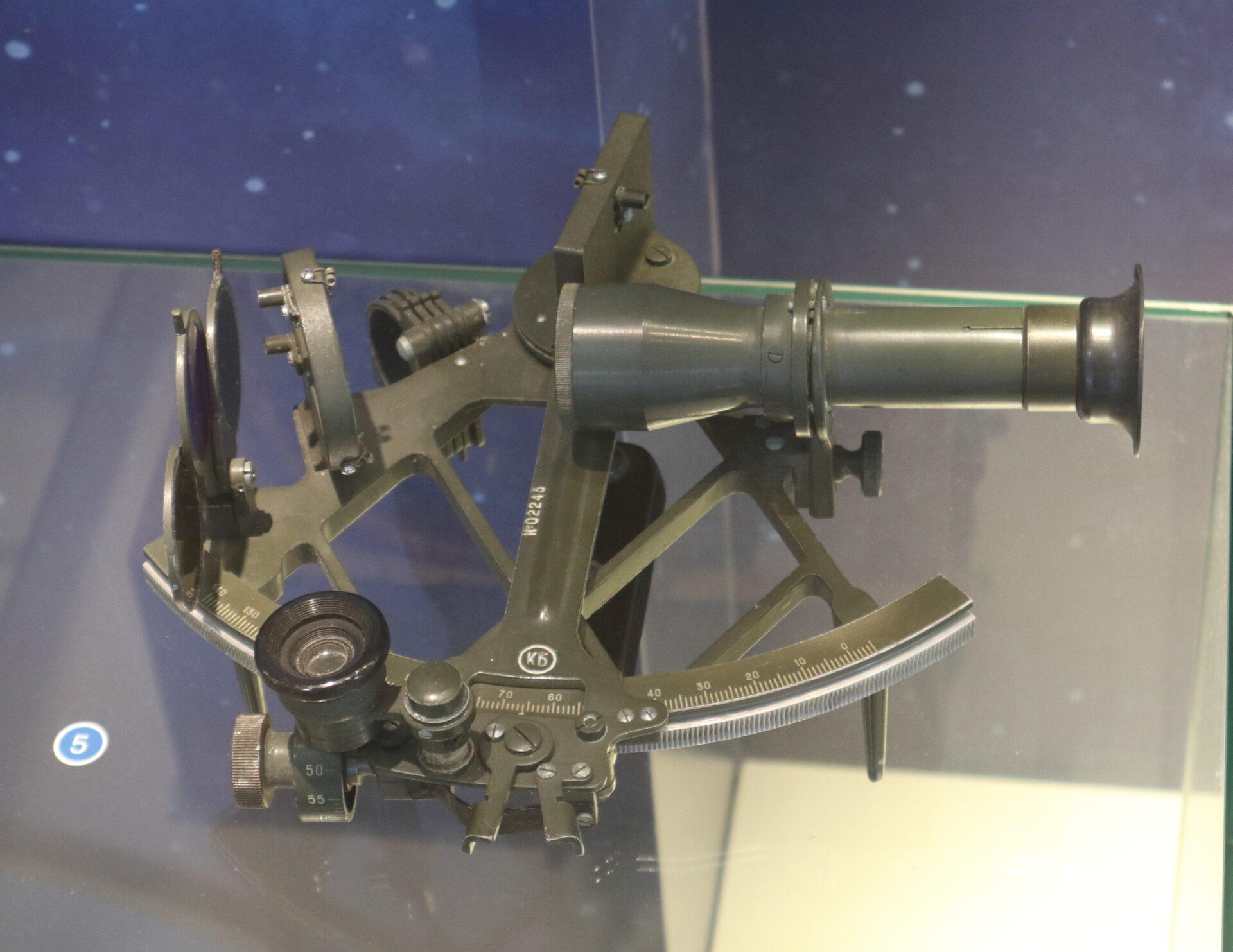
A clock was not the only way to obtain reference time. The lunar-distance method measured the angular separation between the Moon and the Sun or a star, then compared it with calculated tables. Where a timekeeper carried reference time, this method sought to calculate it from the arrangement of celestial bodies.
Александр Сигачёв · CC0 · Wikimedia Commons
Such observations required accurate angle measurements and calculation. Harrison’s work and the astronomical method addressed the same navigational problem in different ways. Neither became universal as soon as a successful instrument or table appeared. Skill, cost, trust and distribution all mattered.
A new use for accurate time
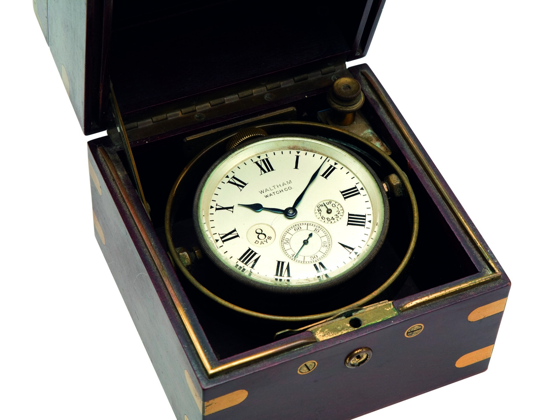
Early precision marine timekeepers were expensive and difficult to make. Later makers simplified designs and improved production, allowing adoption to spread. The later marine chronometer below is not Harrison’s H4; it illustrates the subsequent development of instruments that preserved reference time at sea.
Waltham Watches · CC BY-SA 3.0 · Wikimedia Commons
The answer to our opening question is now clear. A marine timekeeper was not a machine that automatically displayed coordinates. It preserved the time at one place so that it could be compared with time determined at another. Earth’s rotation connected that time difference with an east–west angular difference.
Harrison’s achievement is compelling not only because of the intricate parts inside his machines. It helped make a remarkable connection usable at sea: keeping accurate track of passing time could help determine an otherwise unseen position.
References
- Royal Museums Greenwich — What is longitude?
- Royal Museums Greenwich — Longitude found – the story of Harrison's timekeepers
- Royal Museums Greenwich Collections — H4
- Royal Museums Greenwich Collections — H3
- Royal Observatory Greenwich research website — Transcripts of the Longitude Acts
- Royal Museums Greenwich — Longitude found: Nevil Maskelyne and the lunar method
- Royal Museums Greenwich Collections — H1
- Royal Museums Greenwich Collections — H2
- U.S. Naval Observatory, Astronomical Applications Department — The Equation of Time
- NASA Goddard Space Flight Center (archival educational page) — Latitude and Longitude