
A curtain of rain hangs below a cloud. Yet its streaks fade halfway down the sky, leaving clear air beneath them. It may seem that all the water falling from a cloud must reach the ground, but it can change on the way down. The key to this scene is virga.
What matters is the air between the cloud and the ground. If precipitation passes through a dry layer after leaving the cloud, it may evaporate or sublimate before reaching the surface. There is still a journey between precipitation forming in the sky and the ground beneath us getting wet.
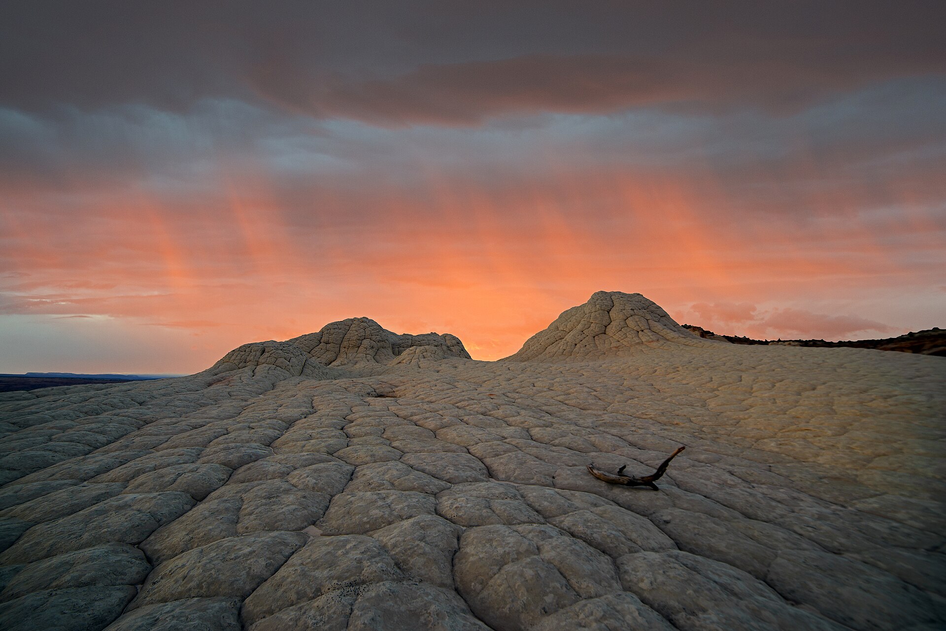
John Fowler from Placitas, NM, USA · CC BY 2.0 · Wikimedia Commons
What are the tails beneath a cloud?
The World Meteorological Organization (WMO) describes virga as vertical or slanting trails of precipitation descending from the underside of a cloud without reaching the Earth’s surface. Although its Korean name contains the word “cloud,” virga is not a separate cloud type like cumulus or cirrus. It is a supplementary feature recorded with a cloud. The Korea Meteorological Administration’s observation guidelines also identify the phenomenon by the name virga. [1] [9]
From a distance, the trails can look like brushstrokes or the tentacles of a jellyfish. The important distinction is that they are not “visible water vapor.” What we see is a trail of precipitation made up of water droplets or ice particles. Water vapor in its gaseous state is invisible. [2] [5]
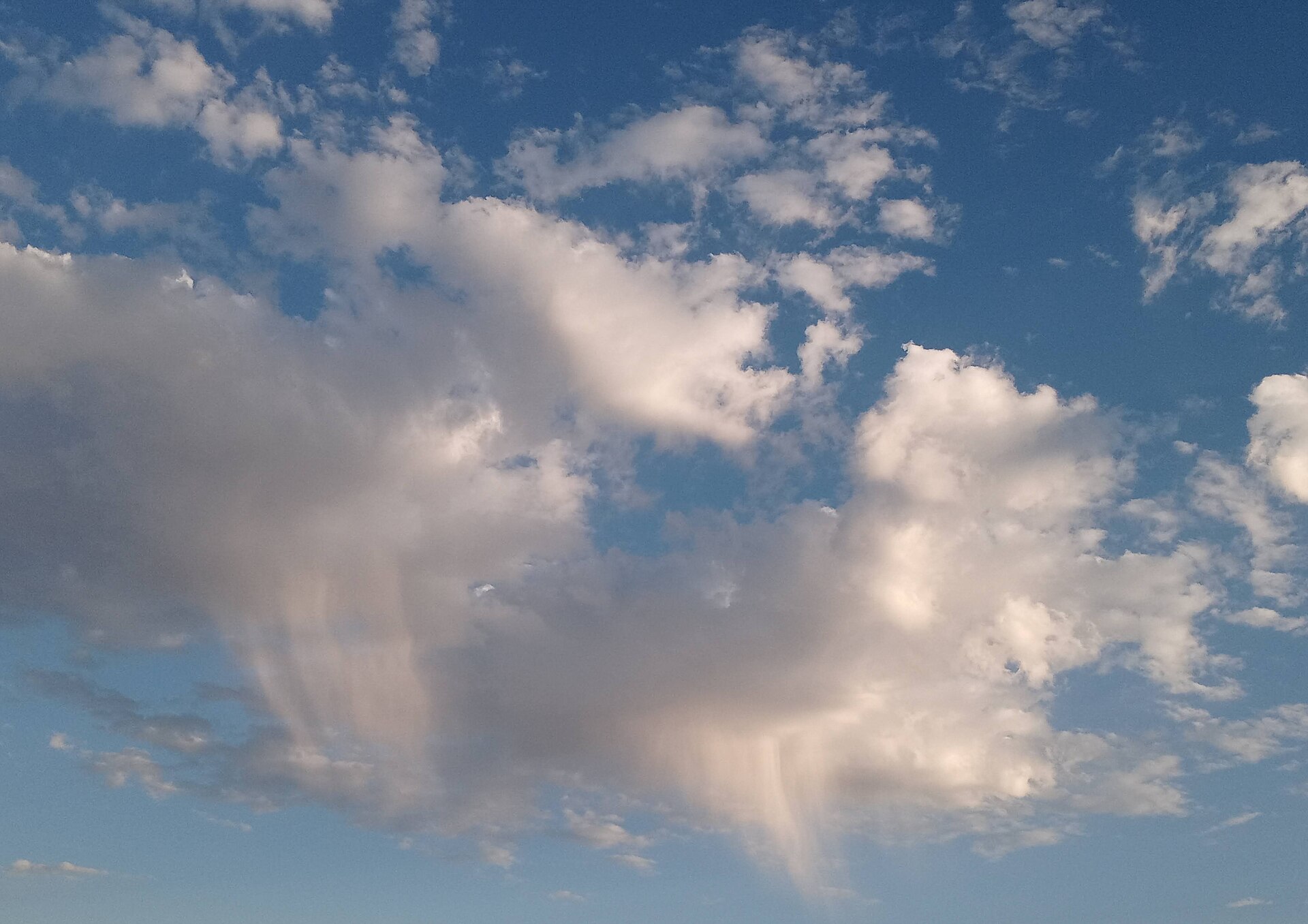
Rivervictorlauramarie · CC0 · Wikimedia Commons
Rain can evaporate while it falls
We often think of evaporation as what happens when a puddle dries after the rain stops. But a water droplet does not have to reach the ground before it starts evaporating. If the air below a cloud is dry enough, water in a falling raindrop can turn into vapor. If the droplet does not survive the trip to the surface, precipitation falls from the cloud but never arrives at the ground. [2] [3]
Ice particles can meet the same fate. When liquid water turns into gas, the process is called evaporation. When ice turns directly into gas without first becoming liquid, it is called sublimation. So we should not assume that every streak of virga consists only of liquid raindrops. The UK Met Office includes both evaporation and sublimation in its explanation of how virga forms. [2]
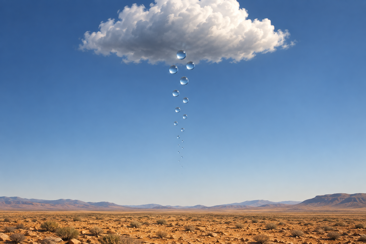
Illustration · AI-generated (Codex/ChatGPT subscription). Created to explain evaporation during a fall.
The table below summarizes the difference. Here, “disappears” does not mean that the material ceases to exist; it means that visible precipitation particles change into an invisible gas.
| Falling particle | Possible change | If it changes completely before reaching the surface |
|---|---|---|
| Liquid water droplet | Evaporates into water vapor | That droplet does not arrive at the ground as rain |
| Ice particle | Sublimates into water vapor | That ice does not arrive at the ground as solid precipitation |
Droplet size and the air below the cloud both matter
This is also why a cloud’s presence alone tells us little about how much rain will reach the ground. We need to consider both the conditions inside the cloud that produce droplets and the humidity and temperature of the air they fall through, along with the distance from the cloud base to the surface.
A study of observations from Al Ain in the United Arab Emirates compared cases in which rain reached the ground with cases that ended as virga. In that sample, virga was associated with relatively smaller droplets, higher cloud bases, and lower relative humidity estimated at the midpoint between the cloud base and the surface. These findings come from one dry region; no particular humidity or cloud height can be treated as a universal threshold for virga. [7]
The lesson for observing the sky is clear: look beyond the water leaving the cloud to the air it must pass through. Clouds that look equally likely to bring rain can produce different outcomes at the surface.
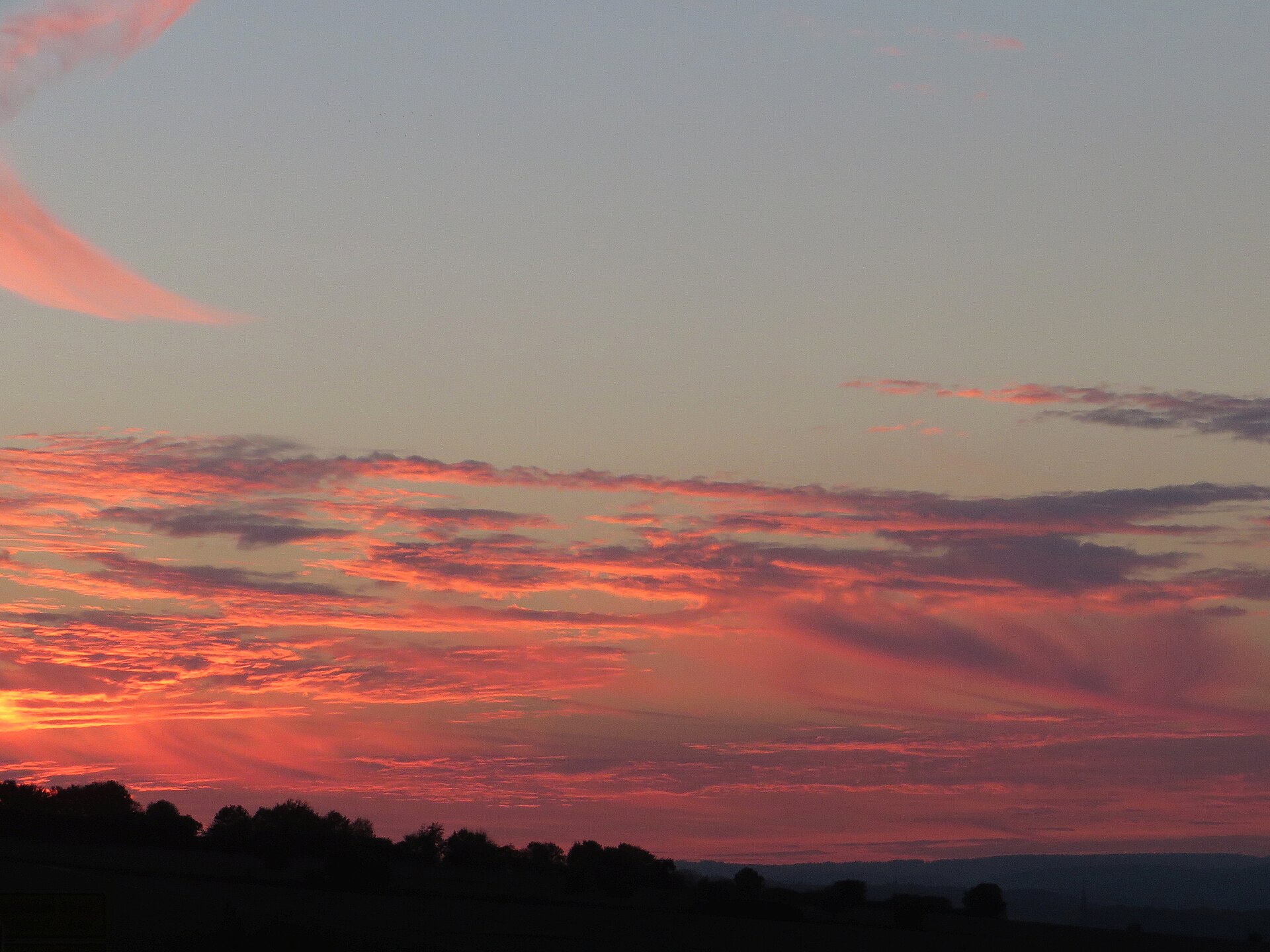
GerritR · CC BY-SA 4.0 · Wikimedia Commons
Why radar shows rain while the ground stays dry
Sometimes a weather radar display shows a precipitation signal even though no rain or snow is falling where you are. Virga is one possible reason. Radar may detect precipitation aloft, but if those particles vanish in a dry layer below, there may be no precipitation to observe at the surface. The US National Weather Service illustrates this with a cross section showing precipitation aloft and dry air below. [3]
The apparent contradiction makes sense once we notice that the observations concern different heights. A radar precipitation signal tells us what is happening above, while a surface observation tells us whether the precipitation completed its descent. Still, a mismatch between radar and the view outside does not always mean virga. It is one possible explanation.
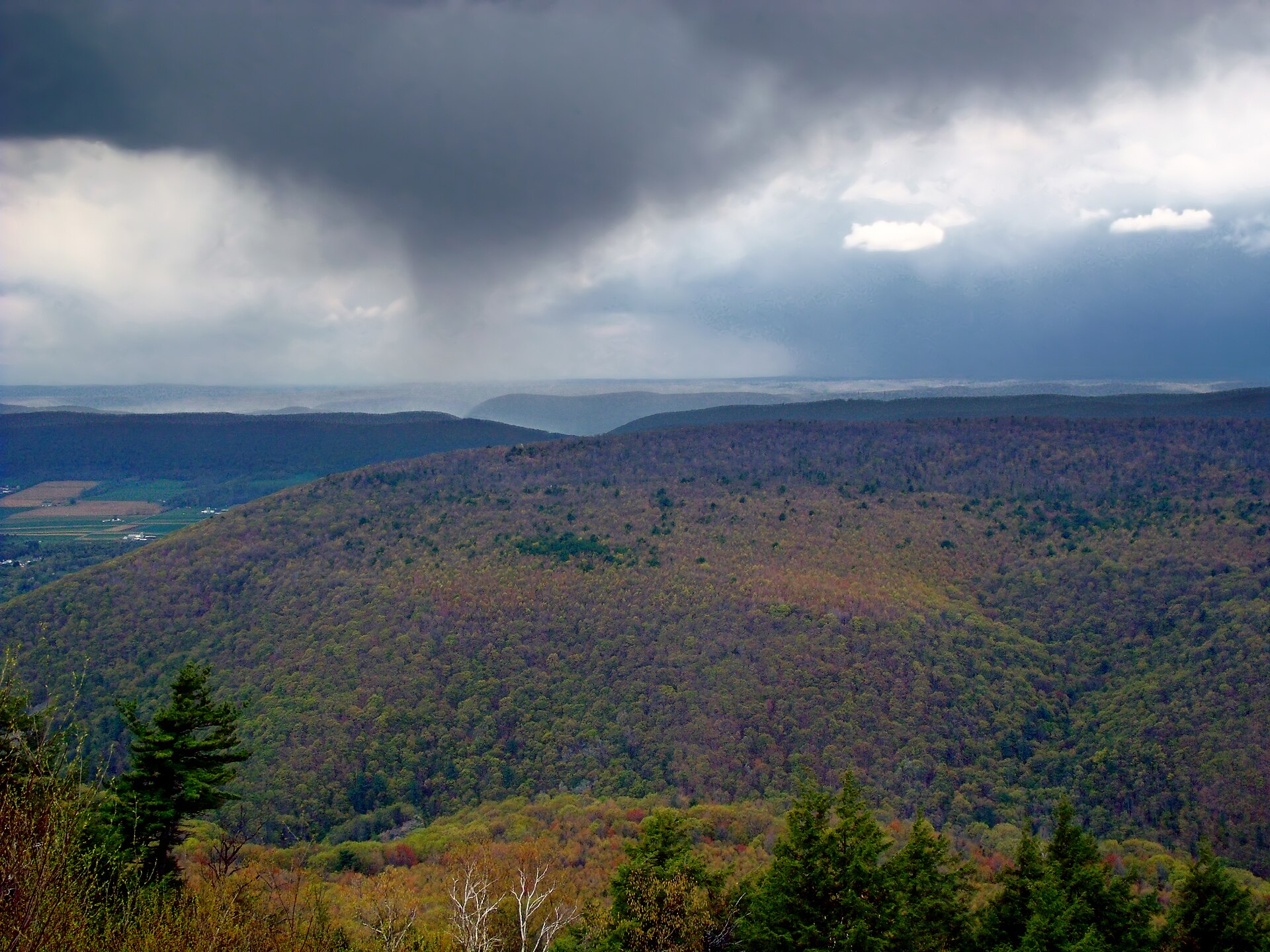
Nicholas A. Tonelli from Pennsylvania, USA · CC BY 2.0 · Wikimedia Commons
What a single photograph cannot tell us
The Hong Kong Observatory distinguishes virga, precipitation trails that do not reach the surface, from praecipitatio, a feature of precipitation that does reach it. Following how far the streaks extend beneath a cloud can help us understand the two forms. [6]
But a streak fading in a photograph does not prove that “all the raindrops there evaporated.” Fraser and Bohren discussed how a change in the brightness of a precipitation trail could also result from the optical effects of melting snowflakes. The photograph might also capture precipitation that has not yet reached the surface. [8]
We should distinguish the definition of virga from the task of identifying it in a photograph. It is more accurate to observe the trail below the cloud, watch how it changes over time, and check surface observations at that location. This article includes photographs identified as virga by their sources, alongside a Pennsylvania photograph used to compare the appearance of distant precipitation. None of these photographs, on its own, establishes the full humidity profile or surface precipitation amount at the time.

Roc0ast3r · CC0 · Wikimedia Commons
The air can change even when rain never lands
Evaporation draws energy from its surroundings and can cool the air. Beneath a thunderstorm, that cooler air can contribute to a downdraft and, in some circumstances, lead to strong gusts or a microburst. The US National Weather Service’s field guide explains that virga or blowing dust may be visible in a dry downburst with little rain at the surface. [4]
That does not mean every instance of virga signals dangerous winds. Equally, rain failing to reach the ground does not rule out the effects of a thunderstorm. Virga describes whether precipitation particles reach the surface; the word does not, by itself, tell us how strong the wind is.
There is weather between the cloud and the ground
Once we know about virga, even the seemingly empty space beneath a cloud looks different. We can ask whether precipitation left the cloud, what kind of air it traveled through, and whether it made it to the surface.
Water falling from a cloud does not necessarily wet the ground. Between cloud and surface, droplets and ice particles can change state in dry air. If you see a slender tail beneath a cloud, consider how far the water’s journey through the sky may have gone.
References
- World Meteorological Organization — International Cloud Atlas — Virga
- UK Met Office — Unusual cloud formations — Virga
- NOAA National Weather Service — Why are there echoes on the radar, but no snowfall?
- NOAA National Weather Service — Weather Spotter's Field Guide — Downbursts
- U.S. Geological Survey — Condensation and the Water Cycle
- Hong Kong Observatory — Supplementary Features and Accessory Clouds — Virga
- Airey et al., Atmosphere (original research) — Characteristics of Desert Precipitation in the UAE Derived from a Ceilometer Dataset
- Fraser & Bohren, Monthly Weather Review (original research) — Is Virga Rain That Evaporates before Reaching the Ground?
- Korea Meteorological Administration — Guidelines for Surface Weather Observations (December 2022, Korean)