
Every year in late June, the Changma rains arrive right on schedule. But this rain does not pass in a day or two — climatologically, it lingers around the Korean Peninsula for nearly a month. Ordinary low-pressure systems and fronts can move hundreds of kilometers in a single day, so why does the Changma front alone seem to plant itself in place and barely budge? The answer isn’t about the front alone — it’s a tug-of-war between two enormous air masses.
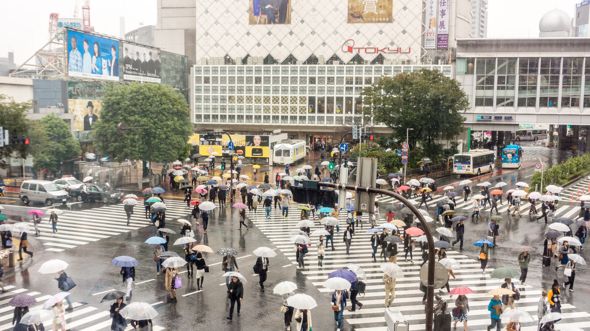
Stationary Front — A Standoff With No Winner
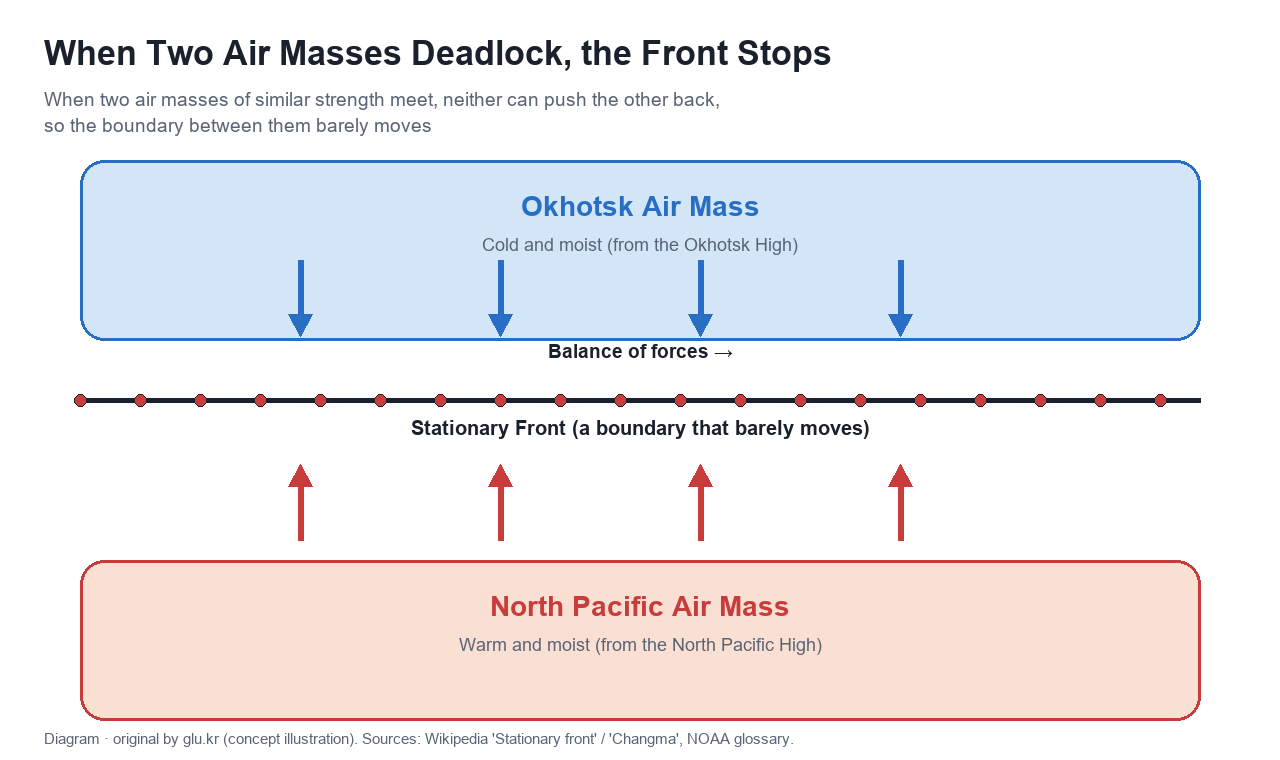
In meteorology, a front is the boundary where two air masses of different character meet. If the warm air mass is stronger it becomes a warm front, and if the cold air mass is stronger it becomes a cold front — either way, the stronger side pushes forward. But when the two air masses are roughly equal in strength and neither can decisively push the other back, the front stalls in place and becomes a stationary front. The U.S. National Weather Service (NWS) defines a stationary front as “a front between warm and cold air masses that is moving very slowly or not at all” — more precisely, one where the two air masses are advancing toward each other at under 9 km/h (5 knots). The Changma front is a textbook example of a stationary front.
The Tug-of-War Between the Okhotsk and North Pacific Air Masses
The two main players behind the Changma front on the Korean Peninsula have traditionally been described as the cold, moist Okhotsk air mass and the warm, moist North Pacific air mass. In early summer, once the two air masses reach comparable strength, a front forms along their boundary and holds its ground between the southern sea and the peninsula, with neither side gaining the upper hand. Recently, however, the Korean Meteorological Society revised the academic definition of Changma for 2026, noting that the “Okhotsk High,” long regarded in textbooks as the source of this air mass, has become questionable in its very existence in recent years. Under the new, broader definition, Changma is now described as “the period when the North Pacific High expands and moves north, creating conditions favorable for heavy rainfall through various mechanisms as warm, moist air from the south meets cold air from the north.” The two-air-mass tug-of-war remains a useful way to understand the phenomenon, but the actual workings of the atmosphere are more complex than that.
How Many Kilometers a Day? Measuring the Stationary Front’s Speed
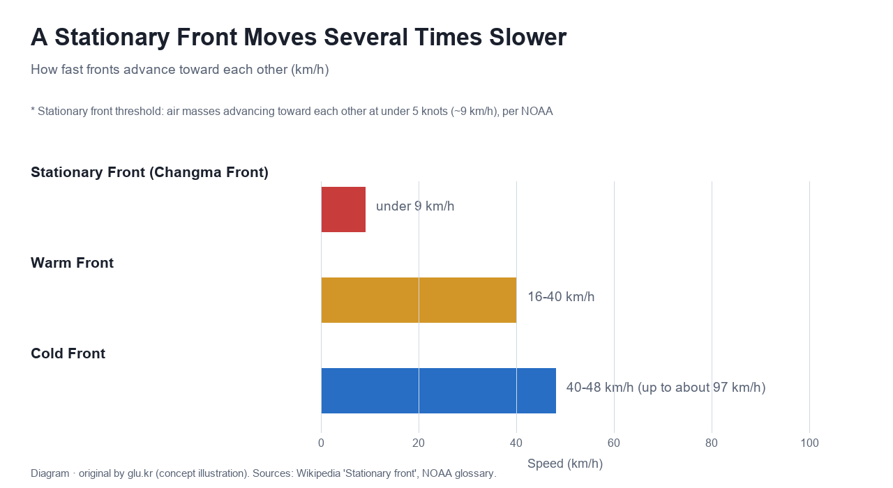
Comparing a stationary front to other fronts makes clear just how slow it really is. A typical mid-latitude cyclone’s warm front moves at roughly 16–40 km/h, and its cold front at 40–48 km/h, sometimes as fast as 97 km/h. A stationary front, by contrast, is defined by the two air masses advancing toward each other at under 9 km/h. Measured against the cold front (up to about 97 km/h), that’s more than a tenfold difference; even against the warm front, it ranges from roughly double to more than quadruple. With a gap that size, it’s no surprise the Changma front spends weeks drifting back and forth between the southern sea and the peninsula without truly moving on. Until this tense balance breaks, the front just keeps circling the same spot.
The Moment the Balance Breaks, Changma Ends
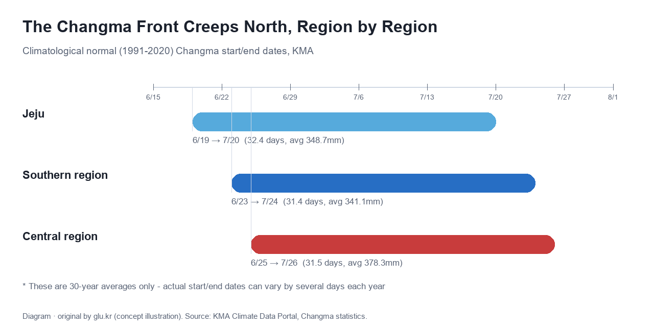
This standoff doesn’t last forever. As summer deepens, the sun-warmed North Pacific High grows steadily stronger and slowly pushes the Changma front northward. Once the front is driven all the way to Manchuria and the entire Korean Peninsula falls under the North Pacific air mass, Changma ends and the hot, humid heart of summer begins. According to the Korea Meteorological Administration’s 30-year climatological normals (1991–2020), Changma runs from June 19 to July 20 in Jeju (32.4 days, averaging 348.7mm), June 23 to July 24 in the southern region (31.4 days, averaging 341.1mm), and June 25 to July 26 in the central region (31.5 days, averaging 378.3mm) — moving from south to north. These day counts are averages of each of the 30 individual years’ Changma lengths, so they can differ slightly, at the decimal level, from simply subtracting the average start date from the average end date. These are only 30-year averages, too — the actual start and end dates can shift considerably earlier or later from year to year. And it doesn’t rain the entire stretch, either: the actual number of rainy days runs only about 17 to 17.7 days per region.
Different Names, Same Front — Meiyu, Baiu, Changma
This stationary front isn’t unique to the Korean Peninsula. The same frontal band shifts latitude with the seasons and goes by different names across East Asia: Meiyu (梅雨) in China, Baiu (梅雨) in Japan, and Changma in Korea. It first appears near Taiwan and Okinawa from May through mid-June, moves to the Yangtze River basin and mainland Japan from mid-June through mid-July, and then advances to the Korean Peninsula and northeastern China from mid-July through mid-August. As its name — “rain that falls while the plums ripen” — suggests, this is a phenomenon peculiar to the East Asian monsoon spanning southeastern China, Taiwan, Japan, and Korea, not a universal pattern found everywhere on Earth. Late in the Changma season, typhoons sometimes push large amounts of moisture toward the front and strongly activate it. Changma in the central region famously lasted 54 days in 2020, from June 24 to August 16 — the longest on record since 1973. That August, Typhoon Hagupit made landfall in China and weakened to a tropical depression, but it kept feeding moisture into the Changma front, activating it and intensifying the resulting downpours. This slow-motion drama — two vast air masses locked in a standoff for weeks before the balance finally tips — is itself a glimpse of how intricately atmospheric circulation is interwoven to produce the rhythm of the seasons.
References
- Stationary front – Wikipedia
- NOAA National Weather Service Glossary – front
- Jeongche-jeonseon (Stationary Front) – Korean Wikipedia
- Jangma (Changma) – Korean Wikipedia
- East Asian rainy season – Wikipedia
- Meiyu front – Wikipedia
- Changma statistics – Korea Meteorological Administration Climate Data Portal
- Jeonseon (Front) – Encyclopedia of Korean Culture
- The 'Okhotsk High' disappears from textbooks: Korean Meteorological Society redefines 'Changma' – MBC News
- 2020 Korean Peninsula heavy rains – Korean Wikipedia
- 2020 Korean Peninsula heavy rain event / August – Namu Wiki